Before we left for the trip, Jen gave me the green light on ordering one along with some of the fun attachments.


One way I decided to use it was to capture some of the amazing scenery while we were driving. There were two things that really surprised me on the drive along the eastern part of the canyon: the variety of terrain and the lack of signs of civilization.
Variety of terrain
Since we were going through the desert I expected mostly rocks and sand, and I expected it to all look mostly the same. It was not that way at all. There were rock structures all around, but some were red, some were pink, some were white, some had streaks of all these. Some mountains gently sloped toward the ground while other had tall sheer cliffs. Some areas had giant sandy mounds while other areas had giants boulders that had apparently rolled off and away from the mountain. We drove through an apocalyptic-looking forest that was consumed by fire in 2006. Even the road varied - sometimes it was dead straight for 20 miles as mountains in front of you grew closer and closer. Then it would swerve and loop and switchback up the mountains. Check out this video for a sampling of what we saw on the drive.
The Desolation
I know it's the desert and all, but I guess I thought that based on the fact that it was such a popular tourist destination that there would be a bit more, well, signs of humanity. At home if I randomly throw a rock I have a good chance of hitting either a Starbucks or a Subway. There are a couple fair sized towns and cities along the loop we drove, but for the most part the areas we drove through were almost totally uninhabited.
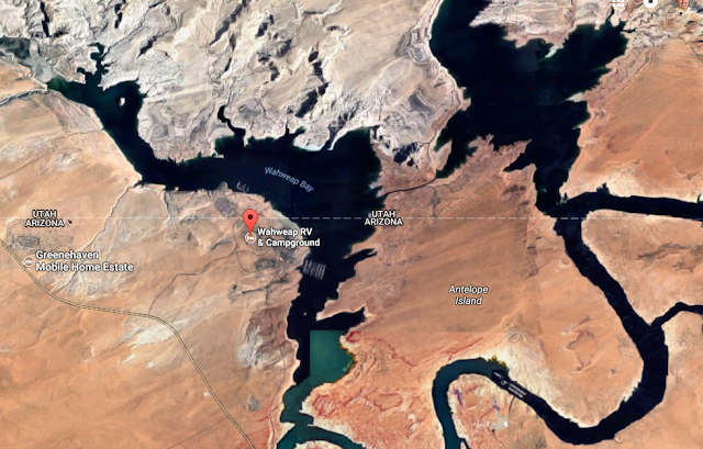
On this day, we drove to Wahweep Campground which is by Lake Powell, very close to the border of Arizona and Utah.
Horseshoe Bend
On the way we were hoping to stop at the picturesque Horseshoe Bend for some quick pictures. It was a jawdropping view. Here's a short video of what it was like below.
 |
| A picture for those who don't have 2 minutes to spare on the video. |
After Horseshoe Bend, we decided to go to the campground and maybe swim at a beach at Lake Powell. After freezing the night before, it was hard to believe the temperatures had now climbed above 100º again. The water in the lake felt good, but it wasn't a very nice beach - it was rocky and weedy. But, it did do the job of cooling us off.
Antelope Canyon
Beth told us that she was interested in taking a tour of Antelope Canyon, a slot canyon on privately owned land that was been formed over time by flash floods. Until fairly recently, the canyon wasn't well known until a photographer used images captured there for a Windows 7 screen saver. It also has been featured in National Geographic and is popular for photographers. |
| I'm not a Windows guy, but I recognized this. |
The canyon itself was thankfully about 20º cooler than than the +100º outside. Our guide wasn't great on providing information, but as a photography student he was really good at capturing pictures. He'd often borrow Rogan's phone and snap the best picture in just the right place with just the right camera setting. Here's a few shots:
He even captured some group pictures using some clever camera tricks.
Deadly Floods
As I mentioned, Antelope canyon is formed by powerful flash floods that occasionally flow through the area. In 1997, a storm 15 miles away dropped an inch of rain in just one hour. This heavy rain created an 11 foot wall of water that flooded the canyon and swept away 12 hikers. Only 1 hiker from the group survived, the guide. According to our guide, he had managed to climb his way near the top and ride out the wave. The survivor was so battered by the incredible force of the wave that all of his clothes were torn off! Our guide said that during a flash flood, all of the metal staircases that get you in and out of the canyon will be torn out of the rock and forced into a ball that eventually washes out into Lake Powell. He told us that as a reaction to the deaths in the 1997 flood, they have installed an early warning system upstream of the canyon to warn them of dangerous floods like this. If interested, read more about this tragic story here. |
| The canyon starts as a narrow slot in the ground and widens out below. |
If you want a taste of how powerful a flash flood there can be, check out this video from a flood here in 2013:
That night we ate dinner at a Mexican place in Page. Tomorrow is a big day as we spend the day on a rented boat on Lake Powell and travel to see Rainbow Bridge.


No comments:
Post a Comment